
So what did I do in San Jose? NOTHING!!! I headed to the desert, again. Well, basically, I looked at Google map. There’s everything on the left, and there’s nothing on the right. So I picked to go to the right! Well, there’s actually one thing on the right, route 130. So that’s easy, just one thing to check out!
Again, not knowing what’s ahead of me, I rented a car and off I went…. Wait, at the car rental, the guy at the counter asked me where I was going that day. I said I wanted to check out the west side of San Jose, route 130. He looked at me confused and said he has no idea what I am talking about….. what the hell!
Ok, so I am really the odd ball in California, constantly going to places where people don’t even have a clue about. Fine, that’s why I am not a Californian!

You see, everytime I see super twisty roads on the map, you know, the type that is to twisty that makes your stomach hurt when you look at them, I get excited. There must be really interesting landscape that sculpted the roads and there must be things that are worth exploring. Plus, I love driving and all motor enthusiasts except red necks love mountain driving.
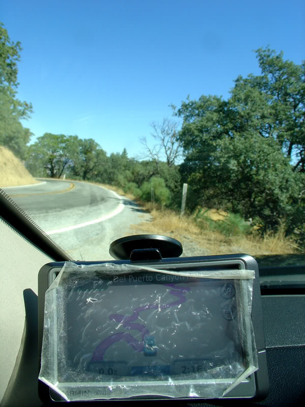
10 min into route 130, I began to wonder if I was asking for too much… as in, am I even ready for this? The roads was narrow. The twistiness is definitely on top of my list, and there’s no lack of unfenced drop offs. It just kept going and going without any space to pull over. It was that narrow. Driving along side the mountain, there was an awesome view of the San Jose valley. You can even see the mountains on the other side, the coast side with the clouds being blocked on the other end. It was a shame that I couldn’t find a spot to stop for a photo.


Not too long into the road, I came across Joseph D Grant County Park. Just like the landscape on Route 101, it was mostly “bread-like” brown with dried grass all over. However, it was really scenic with the rolling hills and twisty roads snaking around the terrain. At Joseph D Grant park, there is a Halls Valley lake. I was there on a Tuesday so there was no one around. It was beautiful, again, much like heaven. Clear cloudless deep blue sky with still lake water. Water birds take off and land on the quiet sunny morning with farm houses on the far side of the lake. What can be more comfortable than to stick around for the rest of the day? That dream was beautiful until one thought struck me.
“Are there mountain lions in this area?”
Perhaps I watched too much Discovery Channel, but the thought of me being alone in the Californian wilderness and tons of bushes for mountain lion to stalk me gave me a slight chill down my spine. I promptly headed back to my car and continued the drive.


Here's the proof that I was in the middle of nowhere!
So up I climbed, and climbed and climbed. Soon, I saw some white spots on top of a peak. As I got higher and closer to the peak, I realize that those are giant space telescopes! May be they are open to the public? I I should just try my luck. It was Lick Observatory owned by University of California, on top of Mount Hamilton. It was quite a spectral view up there. I was basically on the highest point of the peaks looking down at the rest of the landscape. It was just endless of brown mountains layers by layers, separated by the air that made each layer grayer and bluer as it got further away. Atmospheric perspective, a term or technique artist use to display the sense of space. Oh, and there was another amazing thing. Just as I was all alone on the top of the peak standing right below the big dome where the telescope was house, a cyclist arrived. A CYCLIST! This dude freaking climbed the 22mile of mountain roads. He said he tool 2.5 hours… wow, that’s a constant 8~9 mph of climbing all the way up here. Well, he declined to have his photo taken, so no hero shot for him.

On top of the world....

One lonely security booth.

Sun roof!
Since the peak, it was pretty much decent with some climbing. The landscape, although did not change much, became different as it got lower and closer to the sea level. There were more farms, many more farms, but there were very few people around. It was as though no one was really farming and the goats and cows were on their own. One interesting feature I came across numerous times was “Cattle trap”. This is basically a set of railroad bar laid across the road. I couldn’t really figure what it did and how it did it, then I realized that since cattle have skinny legs with hooves, they cannot walk across these bars that have gaps between them, therefore preventing the cattle from venturing beyond the barrier! So humans can drive across it, but not the cattle. Nice! Humans 1: Cows 0


Driving across the mountain range wasn’t boring because I just appreciate such landscape without the need of any reason. It was unique, it was magnificent, and while harsh, it was grand. The drive was pretty much just me on the road with occasional cars going the other direction, so it was lonely but burden free. I didn’t have to wait for anyone. I didn’t have to consider anyone. I can stop whenever I want, and go whenever I am ready. I am on my own schedule, and on my own freedom. I love it!


Occasional signs of human civilization.
After miles and miles of rocky desert, the terrain changes from time to time. From dried grass land to bare rocks. From gentle curves to twisty switch backs. It was a combination of many things with subtle but significant differences.

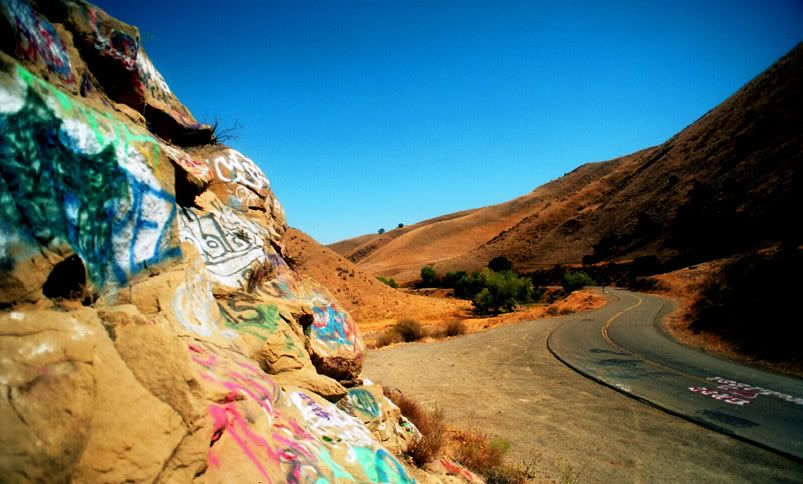

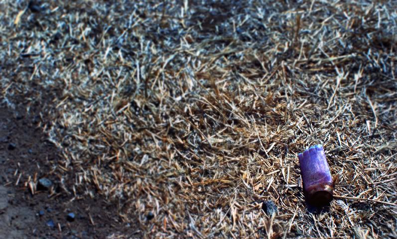
One graffiti filled rock... just one, the one and only, with shattered beer bottles all over it, and condom wraps as well.
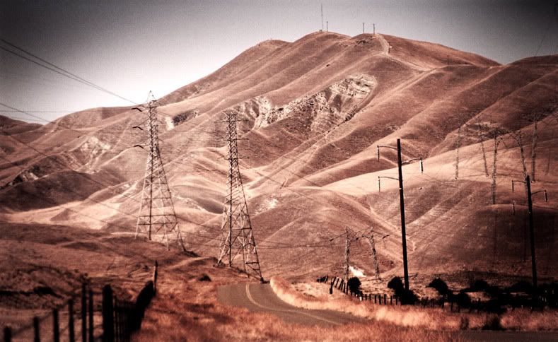
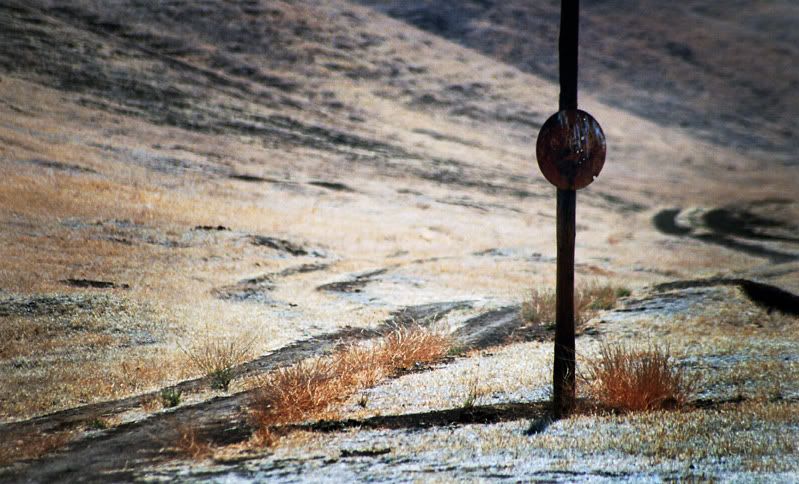
Trigger-happy country.

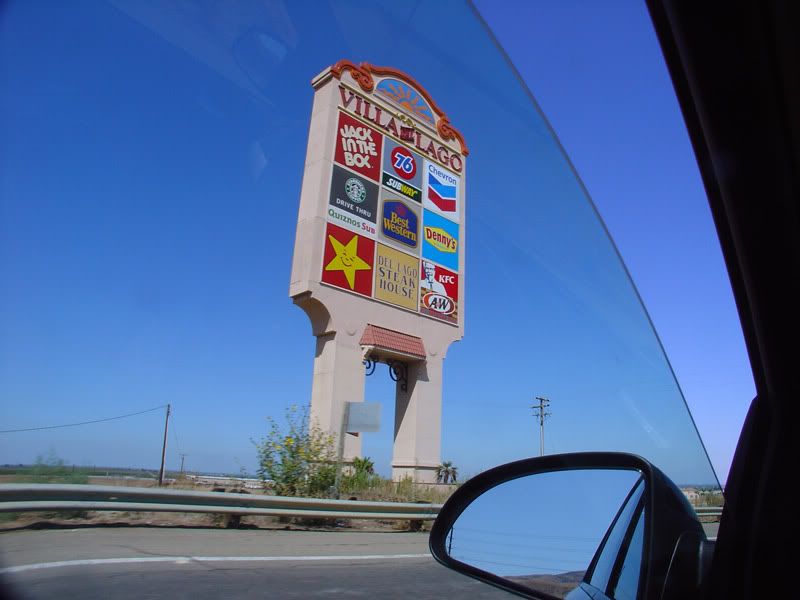
After about 4 hours, I exited the desert and WOAH LAH!!!! The first sign of “oasis” was a tall sign of all the fast food you can imagine!!! All hail humanity!!!
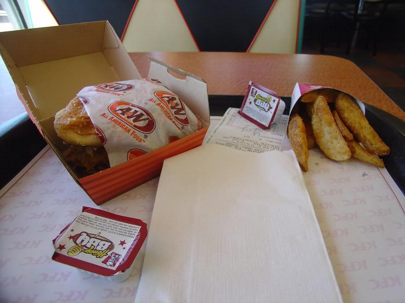
But here’s where the weirdness starts. I decided to go for KFC, which has A&W as well. So I ordered a crispy chicken sandwich meal, and came a sandwich wrapped in an A&W paper and box, with fries in a KFC box. At the soft drink fountain, the cup lid dispensers says “for A&W and KFC cups”. Wow, that’s a hell of branding! I bet those branding guys at both KFC and A&W much be pulling their hair out when some top executive made this decision thinking that it saves cost. What a retard!
Heading back to San Jose, I won’t have enough time to make it back through the same route 130 before dark. I was interested to see what Californian Interstate looks like, so I opted to take I-5 south instead of north. It’s a detour, but since when have I been taking the short cut this trip?
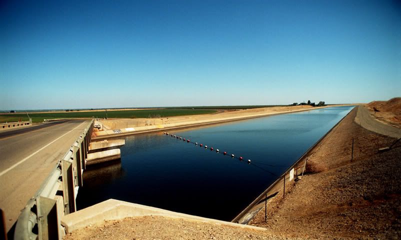
Irrigation canal right beside I-5
Again, it was “bread” hills after “bread” hills. California seems to have a lot of Hispanic influence judging by the various names of roads and places. Well, when I turned on the radio, it was Spanish station after Spanish station, which was really fitting for this journey, in the sense that I have no idea what I am getting into, but I like it!
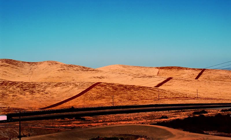
From I-5 south, I had to take route 152 west to get back to the coast and then take 101 north back to San Jose. As I was driving on route 152, I noticed this really tall/huge slope to my left. Immediately, I knew it was some kind of levee. However, this was not just any levee. This was like a 20-storey tall levee! I was trying to imaging what happens when the water level reaches the max, it must be really scary. Fear drove my curiosity. It was a no brainer to turn into the visitor center to check it out.
San Luis Reservoir.
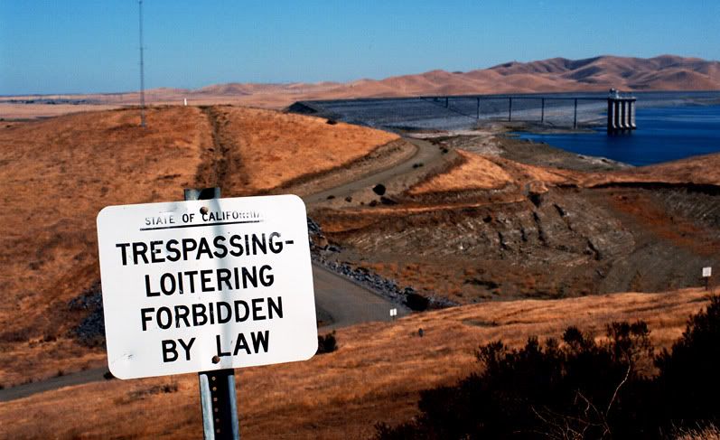
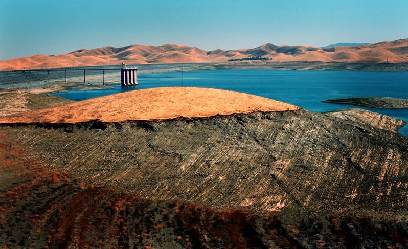
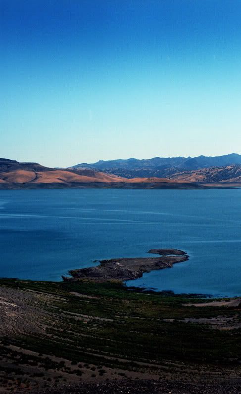
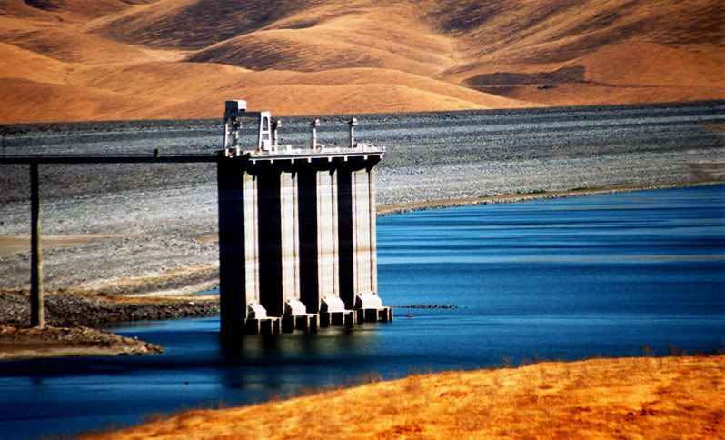
It was no doubt a big reservoir, which made me wonder where all these water came from. However, there wasn’t really much water. There are visible water marks that indicate how deprived water here is. Still, it was a great feat in human power and engineering.
So that almost makes the end of the Californian Tour. What have I learnt about this unique state? Well, first of all, there is a very distinctive lifestyle in California, a lifestyle that doesn’t really care about trying to accommodate to the rest of the country in a positive way. They know who they are and understands how to achieve the desired lifestyle they want. However, it is not the culture that have left the deepest impression in me. It is the sheer unique landscape that is something that I have never experienced before. This is not what California is really known for, but is how I understand California. I wouldn’t say it’s pleasant. Comparatively, I would prefer to live in the north Georgian mountains because the abundance of forest and wildlife, as well as great environment for outdoor sports, however, I will remember Californian desert and those bread hills more than anything else.
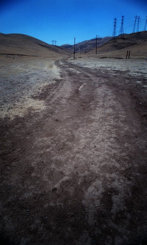
More photos of CA Route 130 HERE
No comments:
Post a Comment